


Following another successful User Group Meeting in Houston in October 2018, last week Getech held the first ever London-based User Group meeting for its European Globe customers at the Geological Society in Piccadilly.
The meeting comprised a mixture of technical presentations and live demonstrations of how Globe has evolved into a powerful, easy-to-use and essential knowledge-base for petroleum exploration, delivered using the market-leading ArcGIS platform from Esri. Participants were able to interact with Getech experts to learn about the high-quality information within Globe, and how it can be used to enhance regional geological understanding and improve petroleum exploration outcomes.
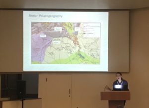 The conference, divided into four sessions, started with an overview of the current release of Globe (v2018) and a series of demonstrations of its new usability features and information content, which comprises data layers for 57 stratigraphic stages from Present Day to Permian. After this, Getech experts gave an in-depth presentation of the progress and plans for enhancing the thermal mapping datasets within Globe, building on an initial delivery of global Curie Depth maps in Globe 2018.
In the second session Getech experts demonstrated how ‘Globe Online’, the web-based version, can be used to view the core Globe datasets such as structure, crustal architecture, paleogeographies and paleogeology, and highlighted the benefits that can be realised by taking Globe with you, for example to data rooms and customer meetings. Presentations on the plans for the next release of Globe (v2019) and a deep dive on Getech’s current Crustal Architecture work were followed by the announcement of a new Getech product for 2019, called Tectonics Online – a secure online information portal that allows geoscientists, plate modellers and geodynamicists access to Getech’s world renowned geodynamics expertise, analysis and data. Tectonics Online is founded on Getech’s market leading G&M data library and calibrated against high-resolution global structural, tectonostratigraphic and geodynamic analyses.
After lunch and a photo call by “the map that changed the world” – William Smith’s famous 1815 geological map of England, Wales and Scotland – the third session focussed on using Globe’s rich datasets to improve play-based exploration outcomes by enhancing sediment provenance studies and a deep-dive on the myriad of datasets that could provide useful inputs into common risk segment mapping workflows.
Finally, participants were invited to comment on and provide input into the forward roadmap for Globe with a variety of options presented for future usability, content and scientific/technical features that are under consideration for future Globe versions. The key takeaway of this session that “the Globe customers own the Globe roadmap” enabled further lively discussion on the items suggested, which continued into the evening at a traditional London pub on Whitehall – wrapping-up what was a hugely successful event and laying the foundations for the 2nd London Globe User Group in 2019.
Written by Chris Jepps, COO, Getech


