In today’s world it is easy to find “answers” to difficult questions simply with the press of a button. However, in an industry where information is vital to decision making, how can the prospectivity of an exploration area be understood if there is no data?
Exploration companies employ the best out there to solve these sorts of problems with experts on stratigraphy, sedimentology, geochemistry, potential fields, even volcanology. But as well as technical knowledge, it is vital those people are willing to push paradigms; voice ideas and be ready and able to defend them; and gather disparate sources of information that can be combined into a coherent story.
Here at Getech, we provide expertise and data for use in natural resources exploration. Our multiclient report team are technical wizards – they are able to gather and interpret sparse and disjointed information from various sources. They then compile this to produce a sensible and realistic scenario for a region. In practical terms this means understanding its evolution, getting to grips with the depositional systems or providing insights into the sediment provenance.
What tools can you use?
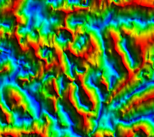
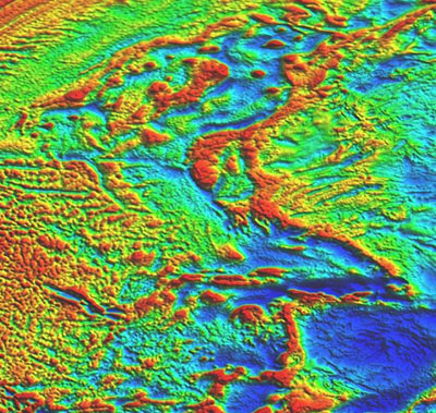 Getech’s legacy is its world beating gravity and magnetic database. It is a global dataset which has evolved and grown, over the last 25+ years. It is unique, combining newly acquired satellite data over the oceans with optimally processed land datasets. This allows our geophysicists and structural geologists to have a detailed picture of gravity and magnetic anomalies which they can use to identify, locate and quantify the variations in the earth’s crustal composition and structure.
We use the wealth of online resources to provide a huge range of inputs – from exploration well locations, drilling results, discovery announcements and third-party datasets. With many of the world’s leading journals also at our fingertips there is amazing amount that can be done from our desks.
How many of us remember the days of spending hours in the library, laboriously photocopying papers!
How can it be done?
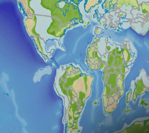
 To set the scene, Getech’s technical experts look to address the key questions of how and when the region and frontier basin formed. We interpret gravity and magnetic data to understand the crustal evolution and identify key structural features. These results are then cross referenced with Getech’s plate model solution. Once we have a picture of when the basins opened, we think about how major tectonic events have affected the margin. This allows us to start thinking about how the depositional environments might have looked through geologic time using our database information, third-party datasets and the vast array of available publications online. The key is bringing all these pieces of information together in a coherent, systematic and complementary understanding that illuminates the evolution of petroleum basins.
What can we show?
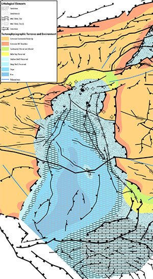 The structural evolution of a basin can be developed using the combined power of gravity and magnetic interpretation. Seismic or outcrop data can help us to understand the formation and timing of features. This in turn allows the exploration geologists to understand the basin and hinterland dynamics, combining the uplifting bedrock and palaeodrainage analysis with the depositional fill of any sedimentary basin to look at the source-to-sink history of a region.
The power of GIS
The ArcGIS platform gives us a unique, dynamic and infinitely customisable way to bring all these pieces of information together. We can build interactive maps of structural, gross depositional environment, palaeodrainage datasets and databases, to name a few. The best thing is the ease with which almost any datasets or images can be brought into the same platform, and how ArcGIS can be used to manipulate and analyse our geologic datasets to create further value-add derivative datasets.
Summary
Drilling a hole to find out what’s there may be the most effective way to know exactly what’s in a basin. But, you want to be mighty sure it’s worth it before you make that commitment. A comprehensive, in-depth examination of the basin using all the non-invasive tools available, then honed into a coherent evolutionary story, can help make sure that decision to drill is the right one.
Written by Clare Davies

