


Gravity and magnetic data are excellent tools to quickly and cost-effectively map subsurface structure and composition over large areas. In the case of groundwater exploration, interpretation of these data helps quantify the depth to target aquifers and/or identify structures acting as conduits for fluid flow.
Following previous successful projects in Tanzania and Uganda, Getech was very pleased to recently provide data and interpretation services to Groundwater Relief to support its work in the Benue State of Nigeria.
The Benue State Groundwater Exploration Project
Groundwater Relief is a specialist charity focussing on the sustainable development and management of groundwater resources. It supports NGOs, local governments and water providers with specific groundwater challenges through a membership of technical experts from all over the world. Groundwater Relief was engaged by an NGO to support it with a groundwater exploration project in the vicinity of two Internally Displaced Persons (IDP) camps in Benue State, Nigeria (figure 1). Water supply had previously been provided to the camps by daily water trucking from a city 30 km out of the area, which is a costly and unsustainable service. The aim of this project was to identify targets for groundwater exploration in the surrounding areas of the two camps in order to provide a sustainable supply of water through a small piped network system.
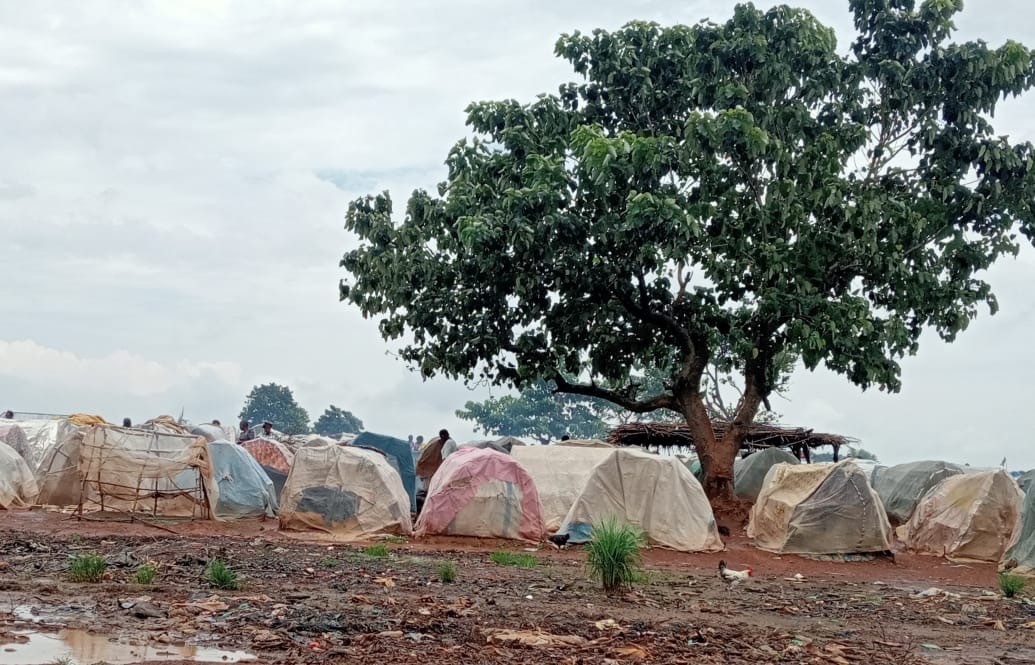
Figure 1: IDP Camps in Benue State
Insight from Potential Fields Data
Groundwater Relief had analysed geological data from the area and was interested in targeting the interface between the shale/limestone Awgu-Ndeaboh group and the underlying basement. It was discovered that there was limited publicly available geophysical data of sufficient quality to interpret depth to basement and therefore to help understand the viability of investing in a new drilling campaign. Fortunately, Getech was able to provide data from its market-leading global database comprising regional gravity and magnetic data. Although the gravity data coverage was relatively poor, the area was covered by a good quality, coherent aeromagnetic survey (figure 2).
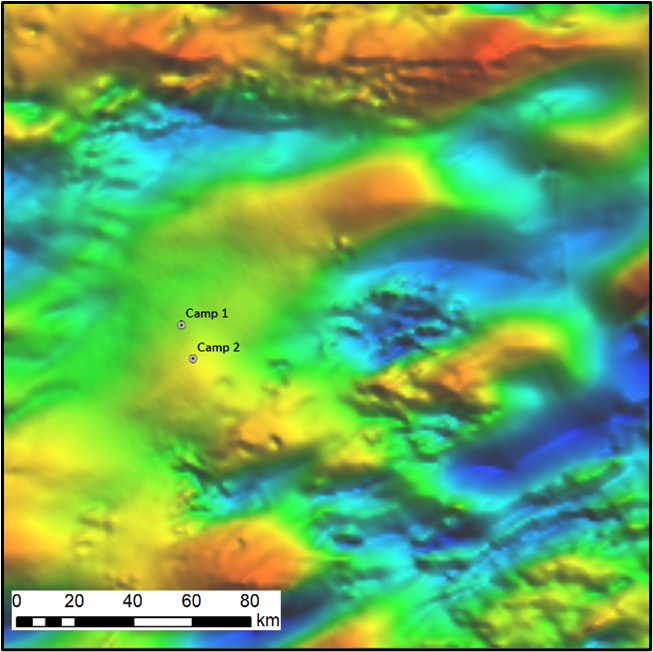
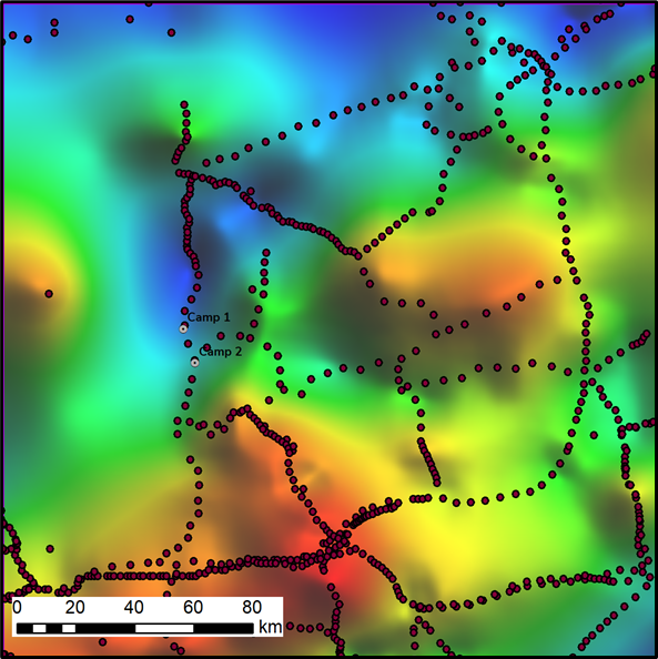
Figure 2: Maps of the Getech (a) gravity and (b) magnetic data. Note the magnetic data are from one coherent survey of 2km flightline spacing.
One immediate observation from the magnetic data was the zone of longer wavelength anomalies running through the central part of the map encompassing Camp 1 and (possibly) Camp 2 (see figure 3 for detail), with shorter wavelength anomalies observed to the south and north.
As the data are all from one coherent survey with a consistent resolution across the area, we are confident that this frequency change is due to subsurface geology rather than data resolution. With magnetic data, the long wavelength anomalies are often due to magnetic source at greater depth, i.e. deeper basement in a basin area where the overlying sediments are almost non-magnetic.
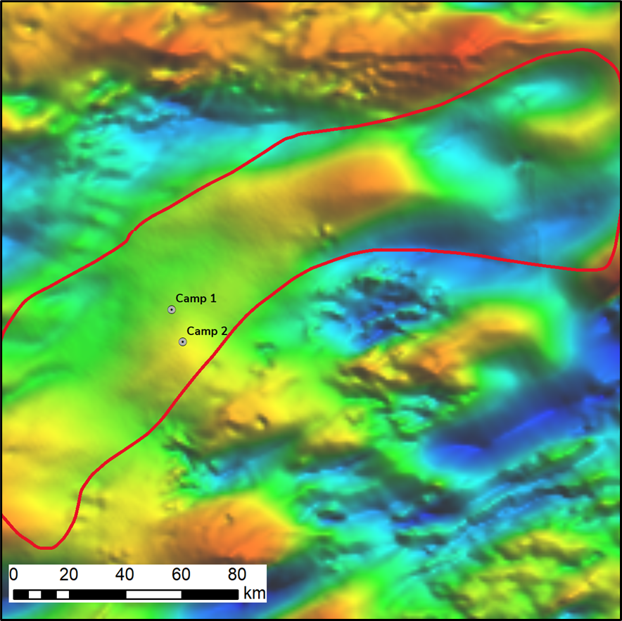
Figure 3: Map of the magnetic data with the low frequency zone highlighted (red polygon).
The conclusion is that there is potentially a NE-SW oriented basin in the vicnity of the camps. Although the geometry is less well constrained, this is consistent with the gravity data which shows a similarly trending and located gravity low. To further quantify this, Getech’s depth to basement interpretation from an inversion of the magnetic data is consistent with the observation of a deep basin running through the area, with potentially up to 6km of sediment in the vicinity of Camp 1 (figure 4).
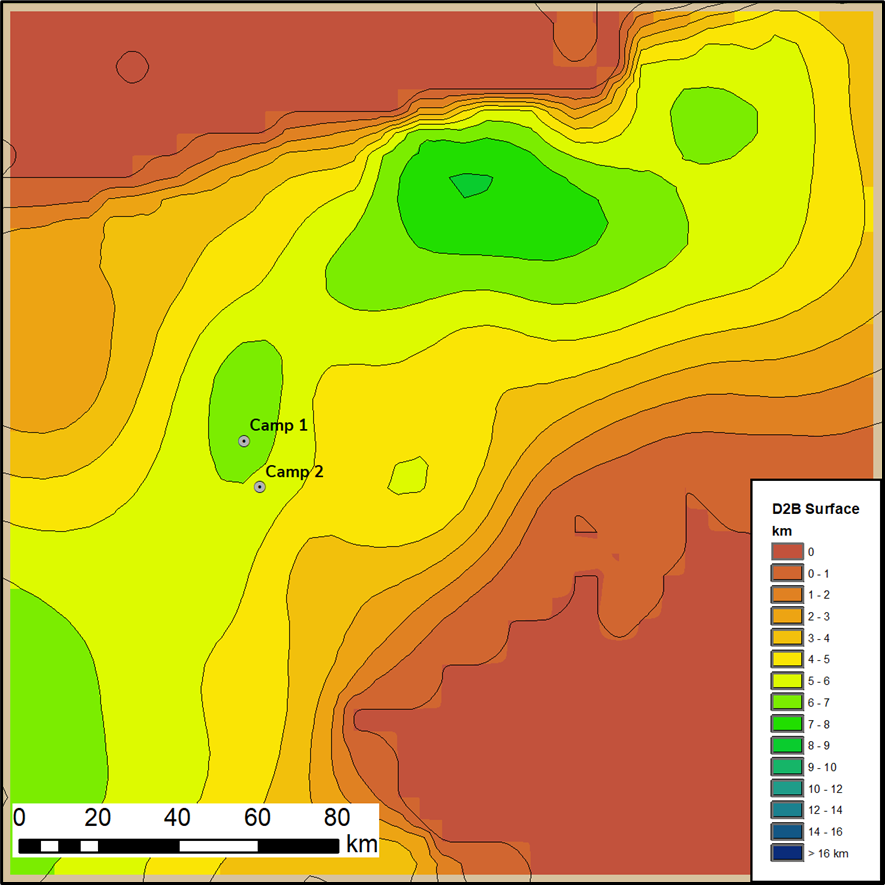
Figure 4: Depth to basement from magnetic inversion.
Implications
The results of this short study give important insights into the depth of the potential target unit. Basement is generally near surface to the southeast and north of the IDP camps and there was significant uncertainty as to whether this shallow basement was also present at the camp locations.
Whilst acknowledging alternative interpretations are possible – an anomalous low density, lowly magnetic granitic basement zone for example could show similar characteristics – the results are compelling in terms of the identification of the basin. The outcomes have helped Groundwater Relief understand the feasibility and risks associated with further work.
Within the next 3 months Groundwater Relief will be supporting the drilling of a deep exploratory borehole to understand the aquifer potential within the top several hundred meters of sediments in the basin identified. If an aquifer is encountered this will lead to a sustainable solution, saving significant money and time in comparison to the current situation of daily trucking of water to the camps. Getech have worked with Groundwater Relief, helping with data and interpretations to provide sophisticated analysis in areas where geological and hydrogeological data is scarce.
For further discussion on this or any gravity and magnetic queries, please contact the Getech team at gravmag@getech.com.
Written by Geraint Burrows and Lucy Whitley (Groundwater Relief) and Simon Campbell and Kaxia Gardner (Getech)